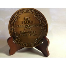
Mount Baker Summit Marker
Also known as Koma Kulshan or simply Kulshan,has the second-most thermally active crater in the Cascade Range after Mount Saint Helens. About 31 miles (50 km) due east of the city of Bellingham, Whatcom County, Mount Baker is the youngest volcano in the Mount Baker volcanic field. While volcanism has persisted here for some 1.5 million years, the current glaciated cone is likely no more than 140,000 years old, and possibly no older than 80-90,000 years. Older volcanic edifices have mostly eroded away due to glaciation.
At 10,781 ft (3,286 m), it is the third-highest mountain in Washington State and the fifth-highest in the Cascade Range, if Little Tahoma Peak, a subpeak of Mount Rainier, and Shastina, a subpeak of Mount Shasta, are not counted. Located in the Mount Baker Wilderness, it is visible from much of Greater Victoria, Greater Vancouver, and, to the south, from Seattle (and on clear days Tacoma) in Washington.
First ascent
Edmund Thomas Coleman, an Englishman who resided in Victoria, British Columbia, Canada and a veteran of the Alps, made the first attempt to ascend the mountain in 1866. He chose a route via the Skagit River, but was forced to turn back when local Native Americans refused him passage.Later that same year, Coleman recruited Whatcom County settlers Edward Eldridge, John Bennett and John Tennant to aid him in his second attempt to scale the mountain. After approaching via the North Fork of the Nooksack River, the party navigated through what is now known as Coleman Glacier and ascended to within several hundred feet of the summit before turning back in the face of an "overhanging cornice of ice" and threatening weather.Coleman later returned to the mountain after two years. At 4:00 p.m. on August 17, 1868, Coleman, Eldridge, Tennant and two new companions (David Ogilvy and Thomas Stratton) scaled the summit via the Middle Fork Nooksack River, Marmot Ridge, Coleman Glacier, and the north margin of the Roman Wall.
A considerable amount of research has been done at Mount Baker over the past decade, and it is now among the most-studied of the Cascade volcanoes. Recent and ongoing projects include gravimetric and GPS-based geodetic monitoring, fumarole gas sampling, tephra distribution mapping, new interpretations of the Schriebers Meadow lava flow, and hazards analyses. Mapping of Carmelo and Sherman craters, and interpretations of the eruptive history, continues, as well. The Mount Baker Volcano Research Center maintains an online archive of abstracts of this work, and an extensive references list, as well as photos.
Mt. Baker
- Brand: Mt. Baker
- Product Code: 199
- Availability: 4
-
$29.95
- Price in reward points: 30
Available Options
Related Products
Mt Rainier
Mt Rainier Summit Markers to commemorate your climb or visit Located in Washington State, Mt Rainier..
$29.95
Mt Whitney
Mt. Whitney Looms over Death Valley, California - the lowest point in the United states ? less than ..
$29.95


