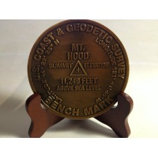
Mount Hood Summit Marker
Called Wy'east by the Multnomah tribe, is a stratovolcano in the Cascade Volcanic Arc of northern Oregon. It was formed by a subduction zone on the Pacific coast and rests in the Pacific Northwest region of the United States. It is located about 50 miles (80 km) east-southeast of Portland, on the border between Clackamas and Hood River counties. In addition to being Oregon's highest mountain, it is one of the loftiest mountains in the nation based on its prominence.
The height assigned to Mount Hood's snow-covered peak has varied over its history. Modern sources point to three different heights: 11,249 feet (3,429 m), a 1991 measurement by the U.S. National Geodetic Survey (NGS) 11,240 feet (3,426 m) based on a 1993 scientific expedition, and 11,239 feet (3,426 m) slightly older origin. The peak is home to 12 named glaciers and snowfields. It is the highest point in Oregon and the fourth highest in the Cascade Range.Mount Hood is considered the Oregon volcano most likely to erupt, though based on its history, an explosive eruption is unlikely. Still, the odds of an eruption in the next 30 years are estimated at between 3 and 7 percent, so the U.S. Geological Survey (USGS) characterizes it as "potentially active", but the mountain is informally considered dormant.
The mountain has six ski areas: Timberline, Mount Hood Meadows, Ski Bowl, Cooper Spur, Snow Bunny, and Summit. They total over 4,600 acres (7.2 sq mi; 18.6 km2) of skiable terrain; Timberline offers the only year-round lift-served skiing in North America.
Mount Hood is Oregon's highest point and a prominent landmark visible up to 100 miles (160 km) away. It has convenient access and a minimum of technical climbing challenges. About 10,000 people attempt to climb Mount Hood each year.
There are six main routes to approach the mountain with about 30 total variations for summiting. The climbs range in difficulty from class 2 to class 5.9+. The most popular route, dubbed the south route, begins at Timberline Lodge and proceeds up Palmer Glacier to Crater Rock, the large prominence at the head of the glacier. The route goes east around Crater Rock and crosses Coalman Glacier on the Hogsback, a ridge spanning from Crater Rock to the approach to the summit. The Hogsback terminates at a bergschrund where Coalman Glacier separates from the summit rock headwall, and then to Pearly Gates, a gap in the summit rock formation, then right onto the summit plateau and the summit proper.
Technical ice axes, fall protection, and experience are now recommended in order to attempt the left chute variation or Pearly Gates ice chute. The Forest Service is recommending several other route options due to these changes in conditions (e.g. "Old Chute", West Crater Rim, etc.).
Mt. Hood
- Brand: Mt. Hood
- Product Code: 202
- Availability: 1
-
$29.95
- Price in reward points: 30
Available Options
Related Products
Death Valley
Death Valley (Badwater Basin) is the lowest point in the lower 48, Death Valley is less than 1..
$29.95
Mt Rainier
Mt Rainier Summit Markers to commemorate your climb or visit Located in Washington State, Mt Rainier..
$29.95
Mt Whitney
Mt. Whitney Looms over Death Valley, California - the lowest point in the United states ? less than ..
$29.95


